From Static Cameras to Dynamic Aerial Coverage
For decades, security surveillance meant fixed cameras mounted on walls and poles, covering predetermined angles with predetermined blind spots. An intruder who studied a camera layout could map every gap in coverage within an afternoon. That fundamental limitation defined the security industry’s approach to property monitoring: add more cameras, accept diminishing returns, and hope that the fixed coverage pattern happened to capture the incident that mattered.
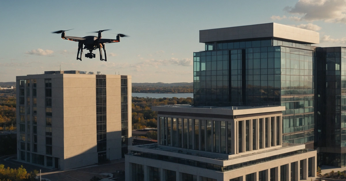
Drone technology has broken that paradigm. A single unmanned aerial vehicle operating at 200 feet provides a surveillance footprint that would require dozens of fixed cameras to replicate. More importantly, that footprint moves. It responds to alerts. It redirects to areas of concern in real time. The shift from static to dynamic aerial coverage represents the most significant change in physical security methodology since the introduction of closed-circuit television.
Our team has integrated drone operations into our security services across Brevard County and the broader Central Florida region, and the operational data confirms what the technology promises. Properties that previously required six to eight ground officers for adequate patrol coverage can achieve equivalent or superior situational awareness with a combination of drone overwatch and a reduced ground team. The economics are compelling, but the real value is operational. A drone sees what ground officers cannot.
What a Security Drone Operation Looks Like
There is a significant gap between consumer drone photography and a professional security drone operation. The difference is process, certification, and integration with a broader security framework.
Mission Planning
Every drone deployment begins with a mission plan. This document specifies the flight area, altitude parameters, sensor configuration, communication frequencies, contingency procedures, and the specific security objectives the flight is intended to support. For a routine patrol flight over a commercial property in Merritt Island, the mission plan may be straightforward. For an event overwatch operation covering a multi-block area in downtown Melbourne, the plan involves airspace coordination, multiple waypoint sequences, and contingency landing zones.
Mission planning also accounts for environmental conditions. Wind speed, precipitation, temperature, and ambient light all affect drone performance and sensor effectiveness. In Central Florida, afternoon thermal convection creates turbulence that limits effective operations during certain hours in summer months. We plan flight windows around these conditions rather than compromising safety or data quality.
Deployment and Monitoring
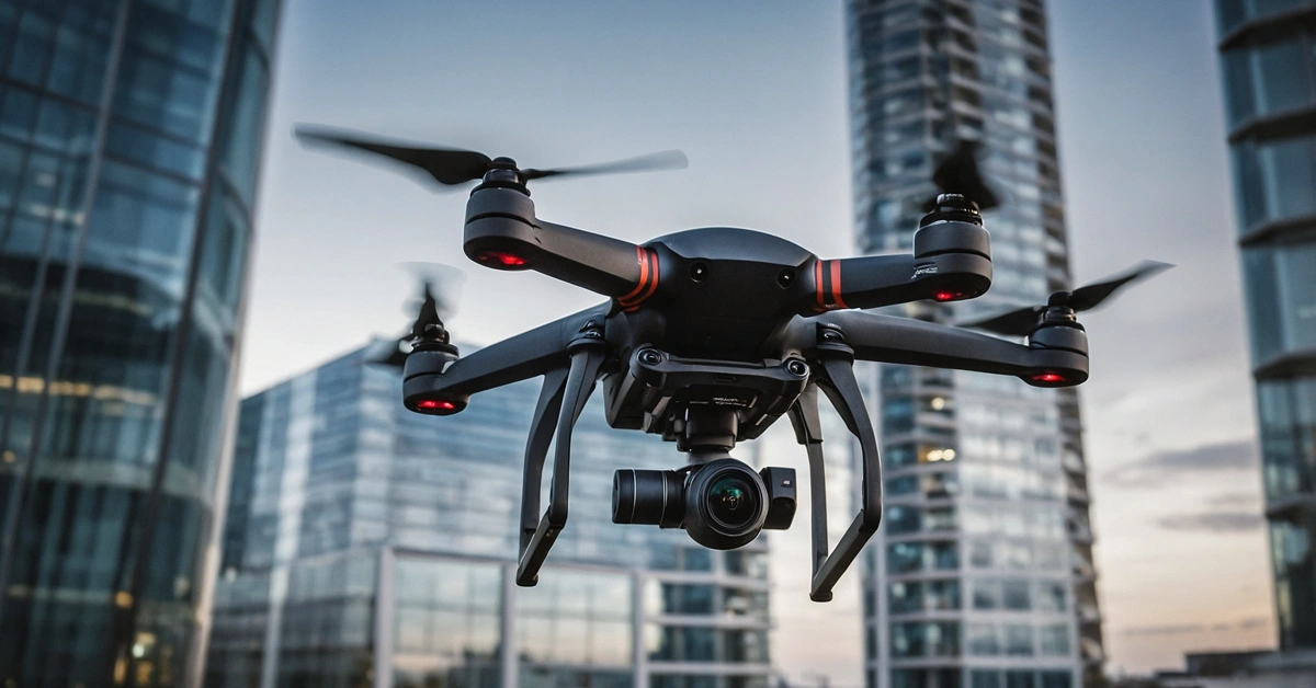
Our drone operations are conducted by FAA-certified remote pilots operating from a ground control station. The pilot maintains visual line of sight with the aircraft at all times, as required by current regulations. A sensor operator manages the camera and detection systems, directing the payload based on real-time intelligence from the ground security team.
Live video feeds from the drone are transmitted to both the ground control station and our monitoring center. This dual-feed architecture ensures that tactical decisions at the scene and strategic oversight from the command center operate from the same real-time information. When the drone identifies an anomaly, whether a perimeter breach, an unauthorized vehicle, or a person in a restricted area, the ground team receives immediate notification with precise location data.
Reporting
Every drone flight produces a mission report that includes flight telemetry data, sensor recordings, incident timestamps, and operational observations. These reports integrate into the overall security record for the property or event, creating an auditable trail that documents what was observed, when it was observed, and what action was taken.
Four Core Applications
Scheduled Patrol
Drone patrol replaces or supplements traditional vehicle and foot patrol along predetermined routes. A drone can cover a perimeter that takes a ground officer 45 minutes to patrol on foot in under 8 minutes at altitude. For large properties, industrial sites, and multi-building commercial complexes in Brevard County, scheduled drone patrol provides consistent coverage at intervals that ground teams cannot match.
We typically program patrol routes as automated waypoint sequences. The drone follows a defined path, pausing at designated observation points to conduct sensor sweeps. The remote pilot monitors the feed throughout and can override the automated route at any point to investigate an anomaly.
Event Overwatch
Aerial perspective transforms event security. From 150 to 200 feet, a drone operator can observe crowd density patterns, identify developing congestion points, monitor perimeter integrity, and detect disturbances before they escalate. Ground officers operating within a crowd have a field of view measured in yards. A drone has a field of view measured in acres.
We have deployed event overwatch for outdoor gatherings across Brevard County, from waterfront festivals to large-scale sporting events. The aerial feed gives our operations commander a real-time picture of the entire event footprint, enabling proactive resource deployment rather than reactive response.
Site Inspection
Construction sites, solar installations, large-acreage agricultural properties, and infrastructure facilities all benefit from drone-based security inspection. These sites often present terrain or scale challenges that make comprehensive ground inspection impractical. A drone equipped with high-resolution optical and thermal sensors can inspect an entire solar farm perimeter in a fraction of the time required for a vehicle patrol, identifying fence breaches, equipment tampering, or unauthorized presence.
Post-storm damage assessment is another inspection application with particular relevance in Central Florida. After a hurricane, our drones provide rapid aerial assessment of client properties while roads may still be impassable, giving property managers actionable information hours before ground teams can access the site.
Rapid Response
When an alarm activates or a ground officer reports a potential breach, response time determines outcome. A drone can be airborne and over the incident location within minutes, providing real-time aerial intelligence to responding ground officers. This advance information allows the ground team to approach with full situational awareness: how many individuals are present, where they are positioned, whether vehicles are staged nearby, and what the safest approach route is.
Rapid response drone deployment has proven especially valuable for large properties where ground response times are measured in minutes. An intrusion alarm at the far corner of a 50-acre industrial site might take a ground officer 5 to 7 minutes to reach by vehicle. A drone reaches the same location in under 90 seconds and begins transmitting useful intelligence immediately.
FAA Regulatory Framework
Part 107 Certification
All commercial drone operations in the United States fall under FAA Part 107 regulations. Every remote pilot on our team holds a current Part 107 Remote Pilot Certificate, which requires passing an FAA knowledge examination covering airspace classification, weather theory, aeronautical decision-making, regulations, and emergency procedures. Certificates must be renewed every 24 months.
The aircraft themselves must be registered with the FAA, and each carries a unique registration number. We maintain current registration and airworthiness documentation for every drone in our fleet.
Airspace Considerations
Brevard County presents unique airspace challenges. The proximity of Melbourne Orlando International Airport, Patrick Space Force Base, Cape Canaveral Space Force Station, and Kennedy Space Center creates a complex airspace environment with multiple restricted and controlled zones. Operations near these facilities require advance authorization through the FAA’s Low Altitude Authorization and Notification Capability (LAANC) system or, in some cases, direct coordination with facility air traffic control.
We maintain current airspace maps for every area in which we operate and build airspace authorization into our mission planning process. Our clients do not need to understand FAA airspace classification. They need to know that our operations are legal, authorized, and will not be interrupted by regulatory issues.
Thermal and Night Vision Capabilities
Optical cameras are effective during daylight and adequate lighting conditions. Security threats do not limit themselves to those hours. Our drone fleet includes aircraft equipped with thermal imaging sensors that detect heat signatures regardless of ambient light conditions. A person moving through a dark property perimeter at 2 a.m. is invisible to a standard camera at altitude. To a thermal sensor, that same person is clearly visible against the cooler ambient background.
Thermal imaging also supports fire detection during post-storm operations and identifies electrical hotspots during infrastructure inspection. The technology serves multiple security and safety functions beyond simple surveillance.
Cost Comparison
The economics of drone security operations favor integration over replacement. A single ground security officer on an 8-hour shift represents a known cost. A drone operation supplements that officer’s effectiveness, extending their effective coverage area by a significant multiple. For properties that currently require multiple ground officers solely to achieve patrol coverage, replacing a portion of that coverage with drone operations reduces total security cost while improving response capability.
We do not position drones as a replacement for ground officers. Human judgment, physical presence, and the ability to interact directly with individuals on the property remain essential security functions. Drones extend the reach and awareness of a ground team. The optimal configuration is a smaller, more effective ground team supported by aerial intelligence.
Florida Drone Privacy Law
Florida Statute Section 934.50, the Freedom from Unwarranted Surveillance Act, governs drone use with respect to individual privacy. The law prohibits the use of drones to conduct surveillance of individuals on private property with a reasonable expectation of privacy, with specific exceptions for law enforcement with a warrant and certain other defined circumstances.
Our operations are designed for property security, not individual surveillance. We operate over client properties or public spaces for event security, and our sensor operations focus on perimeter integrity, access point monitoring, and threat detection rather than personal identification. We maintain strict data handling protocols that govern how sensor recordings are stored, who has access, and when recordings are deleted. Compliance with Section 934.50 is integrated into our operational procedures and pilot training.
The Future of Aerial Security
The regulatory and technological trajectory points toward expanded drone capability in private security. Several developments are on the near horizon.
Beyond Visual Line of Sight (BVLOS)
Current regulations require the remote pilot to maintain visual contact with the drone. BVLOS waivers, which allow operations beyond the pilot’s direct sight, are increasingly being granted for specific use cases. As BVLOS becomes more broadly authorized, drone patrol operations will be able to cover larger areas from centralized control positions, further improving the economics and effectiveness of aerial security.
Autonomous Operations
Drone-in-a-box systems that launch, fly a programmed patrol, and return to a charging station without pilot intervention are entering the commercial market. These systems enable persistent aerial coverage with minimal human input, effectively creating a mobile camera system that repositions itself throughout the day. We are evaluating these platforms for integration into long-term property security deployments in Brevard County.
AI-Powered Detection
Machine learning algorithms that process drone sensor feeds in real time are advancing rapidly. These systems can identify specific object types, detect behavioral anomalies, and generate automated alerts without human review of the raw feed. The integration of AI detection with drone sensor platforms will reduce the workload on human operators and improve detection reliability, particularly for large-area surveillance operations.
The convergence of autonomous flight, AI-powered detection, and regulatory evolution is creating an aerial security capability that did not exist five years ago. Our investment in drone operations today positions our team and our clients to adopt each advancement as it becomes operationally viable and legally authorized.